Infrared Building Facade Inspection
Identify envelope failures, missing insulation, thermal bridging, and water intrusion with high-resolution drone thermography. Non-invasive envelope diagnostics across NC.
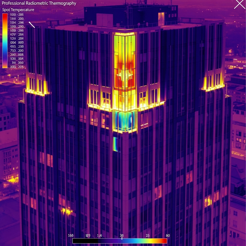
Overview
Building envelope failures cause massive energy loss, tenant comfort complaints, and structural degradation — and they hide behind cladding where visual inspection can't find them. Inspecting a high-rise facade traditionally requires swing stages or rope access, both expensive, slow, and visible to tenants. Holmes and Watson scans entire elevations with a drone-mounted radiometric thermal sensor, identifying missing insulation, thermal bridging, gasket failures, and water intrusion in a single morning — without scaffolding, without anchors, and without disrupting the building.
Why Choose Drone Facade & Envelope Thermography
A drone facade scan finishes in hours what scaffold-based inspection takes weeks to do. The non-invasive nature is critical for historic envelopes, occupied tenant buildings, and facades where mechanical anchoring would itself cause damage.
When to use it: Use facade thermography during commercial real estate acquisition due diligence, when chasing recurring tenant comfort complaints, before major envelope capital decisions, after any envelope-affecting weather event, and as part of an annual envelope condition program.
What We Inspect
- Curtain walls and unitized glass facades
- Masonry, brick, and CMU exteriors
- Window seals and glazing systems
- EIFS and stucco cladding
- Metal panel systems
- Expansion joints and through-wall flashing
Our Process
Assessment
Reviewing building drawings, prior thermal data, and tenant complaint history; planning vertical flight grids around airspace and adjacent structures.
Capture
Executing automated vertical grids that ensure consistent overlap, resolution, and orientation for every elevation.
Processing
Stitching imagery into 2D thermal elevation maps and (optionally) 3D thermal building models.
Delivery
Providing actionable, prioritized data to engineers and architects for remediation planning.
Deliverables
Vertical thermal elevation maps, paired side-by-side visual/thermal imagery, optional 3D thermal point cloud, prioritized anomaly report keyed to building drawings.
Cost Factors
- Building height and total facade square footage
- Number of elevations and complexity of geometry
- Airspace authorization (Class B/C airspace adds coordination)
- 2D thermal elevations vs. full 3D thermal model deliverable
- Combined roof + facade missions are significantly cheaper than separate visits
Frequently Asked Questions
Related Services
Industries We Serve
Facade & Envelope Thermography by Service Area
Request Facade & Envelope Thermography
Get a detailed proposal and flight plan for your specific asset.
Get a Quote (540) 632-3458Trust Signals
- • FAA Part 107 Certified Pilots
- • NACHI Thermography Certified
- • Licensed NC Building Class Contractors
- • 20+ Active Industry Certifications
- • Fully Insured for Commercial Operations