Aerial Construction Progress Monitoring
Recurring high-precision drone mapping of your construction site. Orthomosaics, 3D models, and timeline comparisons that keep stakeholders aligned.
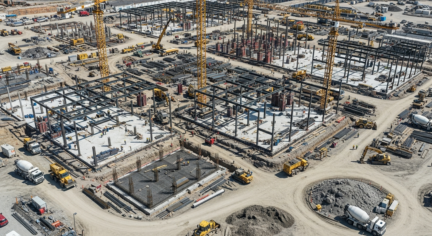
Overview
Managing a large construction site requires constant oversight. Holmes and Watson provides recurring aerial data capture — weekly or monthly — delivering updated orthomosaic maps, 3D site meshes, and progress photos with consistent ground control. The result is an indisputable visual record of site conditions, easier subcontractor management, and remote stakeholders who actually understand what's happening on the ground. (Looking for owner-facing third-party verification with licensed-contractor review? See Commercial Job Site Progress Inspections.)
Why Choose Drone Construction Progress Monitoring
Recurring drone mapping with consistent GCPs produces a survey-grade record of every milestone. Stakeholders who can't visit site weekly can review the cloud-hosted timeline whenever they need to.
When to use it: Use construction progress monitoring for any project where consistent visual documentation supports schedule, dispute avoidance, or stakeholder reporting needs.
What We Inspect
- Site grading and earthwork progress
- Foundation and framing verification
- Material staging and logistics
- As-built vs. design plan comparison
- Volumetric earthwork tracking
- Site-wide schedule documentation
Our Process
Baseline
Establishing a repeatable flight plan and ground control points (GCPs) for accuracy.
Recurring Flights
Executing the exact same flight path at scheduled intervals.
Processing
Generating updated maps, 3D meshes, and digital surface models.
Hosting
Providing access to a cloud platform where users can view timelines and measure distances.
Deliverables
High-resolution orthomosaic maps, 3D site meshes, side-by-side timeline comparisons, and standard progress photo/video packages.
Cost Factors
- Project size and flight duration per visit
- Frequency (weekly, bi-weekly, monthly)
- Cloud viewer access and reporting depth
Frequently Asked Questions
Related Services
Industries We Serve
Construction Progress Monitoring by Service Area
Request Construction Progress Monitoring
Get a detailed proposal and flight plan for your specific asset.
Get a Quote (540) 632-3458Trust Signals
- • FAA Part 107 Certified Pilots
- • NACHI Thermography Certified
- • Licensed NC Building Class Contractors
- • 20+ Active Industry Certifications
- • Fully Insured for Commercial Operations